Cloud Cover Maps for South Africa
Live Satellite Images for Southern Africa Clouds Cover, Cloud Stream, Radar and Rainfall Maps – Copyright 2024 SSEC
Last Updated: 2024-12-20 12:35:04 SAST
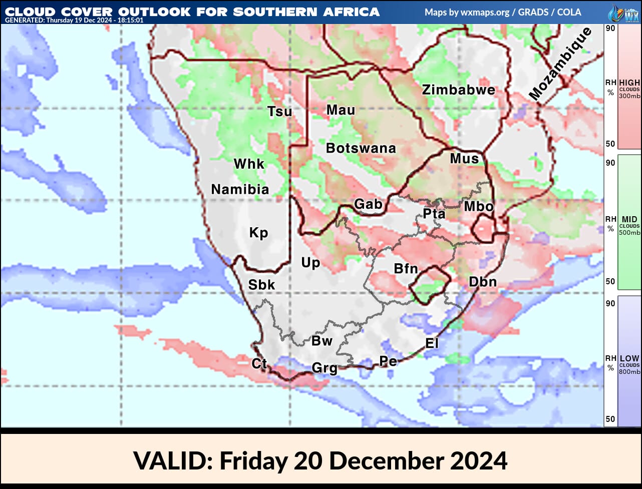
late Cloud Cover Forecast Map for Southern Africa Valid : Friday 20 December 2024

Animated Cloud Extended Forecast Map of South Africa (ECMWF) – Courtesy Windy.com
Click and hold on the map to move around, click on areas for predictions, use your mouse wheel to zoom in and out
high Clouds animate Extended Forecast Map of South Africa ( ECMWF )
Medium Clouds Animated Extended Forecast Map of South Africa (ECMWF)
Low Clouds Extended Forecast Map of South Africa (ECMWF)
Cloud Tops Extended Forecast Map of South Africa (ECMWF)
Cloud Base Extended Forecast Map of South Africa ( ECMWF )
Clouds Visibility Map of South Africa (ECMWF)
CAPE Lifted Index Map of South Africa (ECMWF)
© Copyright notes
The copyright of the article belongs to the author, please do not reprint without permission.


![YouTube TV Channels List: Prices, Addons, Packages [December 2024]](/img/20241225/6zlIEo.jpg)